Where the Meadows Meet the Sky
It wasn’t just another winter trek in Uttarakhand it was like walking straight into a real life mountain fairytale. We packed our cold weather gear and headed into the Garhwal Himalayas, drawn by the promise of vast snowfields and peaceful, uncrowded trails.

The Complete Story of Dayara Bugyal Chasing Snow, Silence, and Endless Meadows in the Garhwal Himalayas
The Call of the Silent Mountains
Some journeys start long before you actually set off. They start on quiet nights, sitting in front of a picture of some remote snow capped peak, wondering what it would be like to be up there where the trees end and the open sky begins.
That’s precisely how the story of Dayara Bugyal starts
Dayara Bugyal in the Uttarkashi district of Uttarakhand is no ordinary spot on a trekking map. In the local Garhwali language, Bugyal means a high altitude alpine meadow (a large meadow of grass on the slopes) and that’s exactly what it is. In summer it’s a carpet of green and wildflowers. In winter (December to March) it’s an entire sea of snow.
Dayara Bugyal (28 sq. km in area, reaching nearly 12,000 ft in elevation) is widely regarded as one of the most spectacular winter treks in India. It’s a trek that you can do whether you’re a complete novice or an experienced trekker looking for some quiet snow country. It’s a very special place indeed in that it offers the unadulterated beauty of the Himalayas without any technical demands.
Setting Out: The Scenic Drive from Dehradun to Raithal
The adventure begins down in the valleys. Leaving behind the bustling streets of Dehradun early in the morning, the road winds upward into the misty heart of the Garhwal region.
Dehradun ➔ Suwakholi ➔ Moriana Top ➔ Uttarkashi ➔ Bhatwari ➔ Raithal Village (Base Camp)
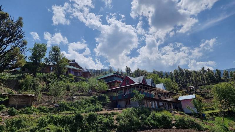
As the wheels roll along the Bhagirathi the air changes completely. It’s no longer the warm air of the city and has a cold, sharp, piney quality to it. You pass through a series of quiet mountain villages, see the terraced farms clinging to the hillsides and get a good look at the distant snow capped peaks. By late afternoon after the 175km drive you reach Raithal which is the base village at 7400 feet. Raithal is a village in a very much more peaceful age. There are the traditional wooden houses with the hand carved window frames all down the narrow stone paths. The people are very friendly and will offer you a cup of hot tea as the evening chill sets in. Spending the night here is not just about sleeping. It’s about allowing your body to acclimatise to the altitude and get ready for the next stages of the trek.
Day 1: Step into the Enchanted Forest (Raithal to Gui Campsite)
Distance: ~5km
Duration: 4 to 5 hours
Altitude: 7400ft to 9880ft
The morning is crisp and clear. You’re off from Raithal with your backpack on and your trekking poles in hand. The first few miles are a gentle, steady climb through the ancient forest of oak, maple and rhododendron. In winter the lower branches of the trees are laden with fresh snow and form natural arches over the path. The sun filters through the canopy in golden shafts, catching the ice crystals in the air.
There is a definite rhythm to every mile. Your breath is turning into little clouds of mist in front of you as you find your stride. The only sounds in the forest are the crunch of your boots on the dry leaves and snow and the occasional call of a Himalayan Monal bird high up in the trees. As the midday sun approaches the forest canopy begins to thin and you start to get a view of the high ridges above. Gui Campsite is reached around midday. It’s a small clearing in the middle of a grove of towering oaks and it’s the first real view of the snow covered ridges. There are a number of small wooden shepherd huts scattered around the clearing which gives the campsite a very rustic feel.
As the day draws to a close the temperature drops dramatically. Tents are pitched and the group gathers around for hot soup and some warm food. The night sky is absolutely spectacular with a million stars visible. It’s far more starry than you’ve ever seen from the plains.
Day 2: The Grand Ascent to the Snowfields of Dayara BugyalDistance
10 to 12km (round trip from Gui)Duration: 7 to 8 hoursAltitude: 9,880ft to 12,000ft (Dayara Top)This is the day you’ve been looking forward to. You wake up early, get properly dressed in layers and start the walk well before the sun comes over the mountain ridges. Leaving Gui behind the gradient becomes a bit steeper and you pass through Chilapada (another very quiet clearing with a natural stream of water). As you go higher the forest gradually gives way to an open slope. Then comes the moment of change. You take one final step over the ridge and the world is suddenly white. You’re standing on the edge of Dayara Bugyal. and Bakaria Top (12,000 ft)
Bakaria Top (12,000 ft)
Dayara Bugyal Summit ➔ 360° View of Gangotri Range
Chilapada Forest
Gui Campsite (9,880 ft)
Raithal Village (7,400 ft)
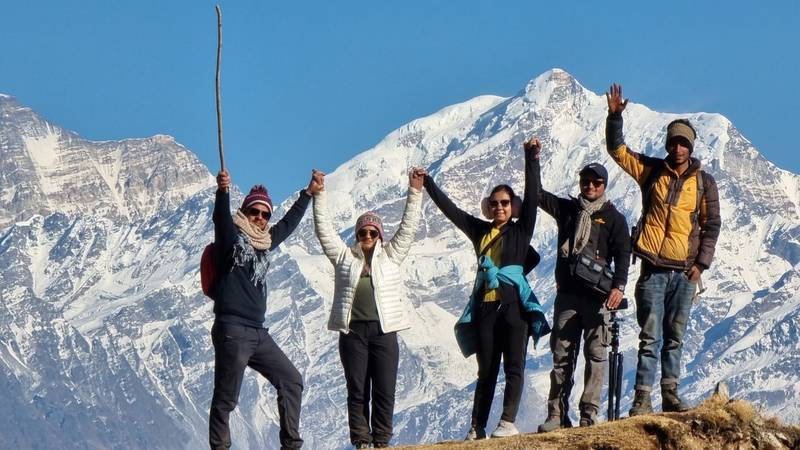
The meadow stretches out in every direction like a huge sea of snow. No trees, no buildings, no sound. Right in front of you is a massive wall of Himalayan peaks: Bandarpoonch (20,722ft) the famous Monkey’s Tail peak shining bright white against the deep blue sky. Kalanag / Black Peak rising right beside it. Srikanth Peak and Draupadi Ka Danda as two sharp, steep ridges cutting across the skyline. The Gangotri range in the distance as huge ice giants. Standing here with your arms outstretched towards the sky, the cold wind in your face, all the effort it has taken to get here is completely gone. You could spend hours just walking across the soft snow slopes, throwing snowballs with your fellow trekkers or just sitting on a dry patch of rock looking at the sheer scale of it all. If you’ve got the energy then you can push up to Bakaria Top which is the highest point of the meadow at 12,000ft and you’re rewarded with a full 360 degree view of the Garhwal Himalayas. After all that, you begin your gentle descent back to Gui as the afternoon sun casts the snow peaks in orange and pink.
Day 3: Returning Home with Memories Stored in the Heart
- Distance: ~5 kilometers (Gui to Raithal)
- Duration: 3 hours
The descent back to Raithal feels different from the climb up. Your boots move with familiar ease along the forest trails. The trees, the wooden homes, and the mountain air feel like old friends now.
Reaching Raithal, you share one final hot meal with your guides and trek mates. Numbers are exchanged, photos are shared, and promises to return to the mountains are made. As the vehicle takes you back down the valley toward Dehradun, you look out the window one last time at the high white peaks gleaming under the afternoon sun.
You came looking for a trek, but you leave with a story that will stay with you forever.
Everything You Need to Know: Complete Trek Planner
To help you plan your own journey to Dayara Bugyal, here is a breakdown of all the essential details:
| Feature | Details |
| Location | Uttarkashi District, Uttarakhand, India |
| Trek Distance | 20 to 24 kilometers (Round Trip) |
| Maximum Altitude | 12,008 feet (Dayara Top / Bakaria Top) |
| Trek Grade | Easy to Moderate (Ideal for beginners & families) |
| Base Camp | Raithal Village (Accessible via road from Dehradun) |
| Duration | 4 Days / 3 Nights (Standard Route) |
| Best Seasons | Winter: Dec–Mar (Snow Trekting) Summer: May–Jun (Green Meadows) Autumn: Sep–Nov (Clear Skies) |
Season Overview: When Should You Visit?
- Winter Wonderland (December to March): Deep snow cover, frozen landscapes, cold temperatures dropping at night. Perfect for snow walks and winter photography.
- Spring & Summer Blooms (April to June): Fresh green grass, blooming rhododendrons, pleasant day temperatures, and vibrant floral carpets.
- Autumn Clarity (September to November): Post-monsoon skies offer crystal-clear, sharp mountain views and golden grass meadows.
Essential Packing List for Dayara Bugyal
Packing right ensures a safe and comfortable trek, especially in cold weather
- Footwear: Sturdy trekking boots with good ankle support and deep grip.
- Clothing (3-Layer Rule):
- Base Layer: Moisture-wicking thermals.
- Mid Layer: Warm fleece or lightweight down jacket.
- Outer Layer: Windproof and waterproof shell jacket.
- Accessories: Warm woolen beanie, neck gaiter, waterproof gloves, and UV-protection sunglasses.
- Gear: 40–50L backpack with rain cover, trekking poles, and a 2-liter reusable water bottle.
- Personal Items: Sunscreen lotion, lip balm, basic first-aid kit, and personal medicines.
Why Dayara Bugyal Belongs on Your Bucket List
Dayara Bugyal is more than just a destination; it is a gentle introduction to the raw beauty of the high Himalayas. It doesn’t demand years of mountaineering experience or extreme physical endurance. All it asks for is a spirit of adventure and a willingness to walk through quiet forests and open skies.
If you have been dreaming of standing in knee deep snow, surrounded by giant peaks under a deep blue sky, Dayara Bugyal is waiting to tell you its story.